

It certainly appears that I'm the primary "contributor" to this thread. I'd really like some of the rest of you to post pictures of places you've been in Colorado, or at least, mention those places of interest.
Back on October 15, I finally got the opportunity to take a drive that I had been wanting to do ever since the Autumn colors started. It seemed that either the weather/clouds wouldn't cooperate or some family event was going on to prevent it from happening.
There are two different "roads" that are in a similar area of Colorado near to Canon City. About four miles east of Canon City is a junction that takes one up through Phantom Canyon Road. That road follows an old rail route that was abandoned after the mining in the area changed. It is a road designated on the maps as 67, although I don't know if it is classified as a forest service road or a county road. It runs from that junction east of Canon City up to the town of Victor, Colorado, which is a mining town.
The second road is Shelf Road and runs from the south side of Cripple Creek (only a few miles from Victor) back down to Canon City itself. I believe it is designated as 88, but again, I'm not sure if it is a county or a Forest Service road. Both roads have parts that are single lane roads, which necessitates one to pull over into a "wide spot" in the road to allow others to pass.
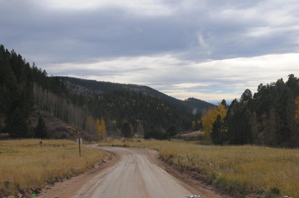
Since I've not gone through and worked the Phantom Canyon Road, this post is only about Shelf Road. It is one that requires a "high clearance" vehicle, although if it isn't washed by rains very much, I would drive a Ford F150 across it. But, being uncertain as to the road's condition, I made the trip that day in my nephew's Jeep Rubicon. Without further ado, allow me to share some photos of Shelf Road.
The start of my trip was from Cripple Creek, Colorado. This image gives no indication of what the road and the terrain will be like later on.

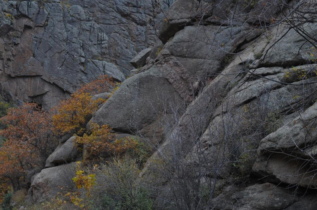
As I was driving along in one section, I spotted this "lady" cross the road in front of me. I stopped and took a picture of her without getting out. (You have to look fairly closely just above and just to the right of the center of the picture. She blends in quite well.)
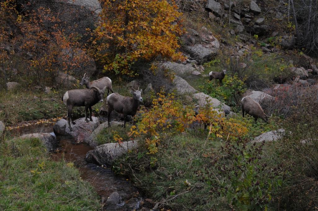
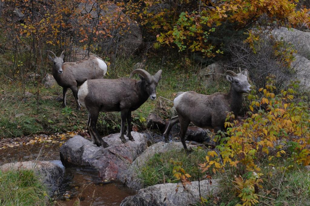
It was a good thing that I didn't get out of the Jeep to take my photo, because when I looked over to my left after taking the above picture, I was met by the rest of the family.
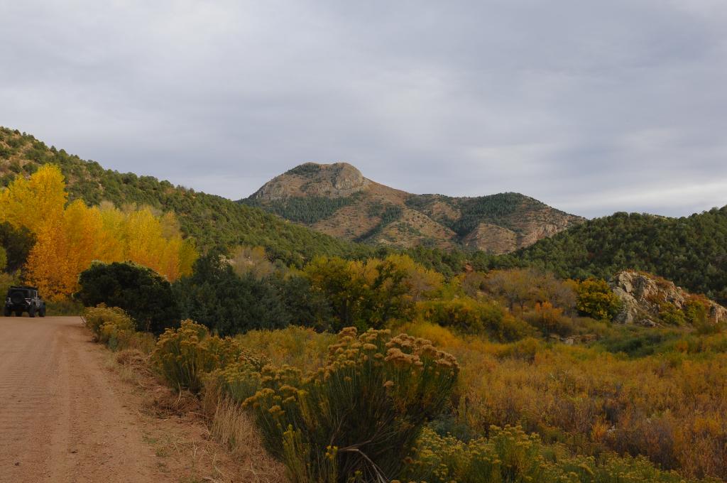
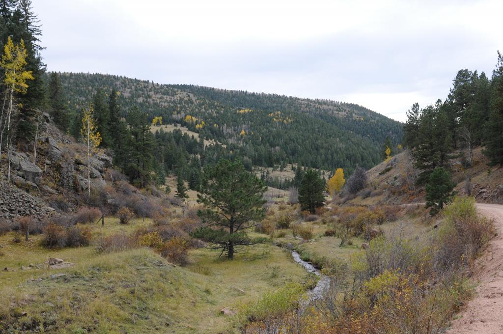
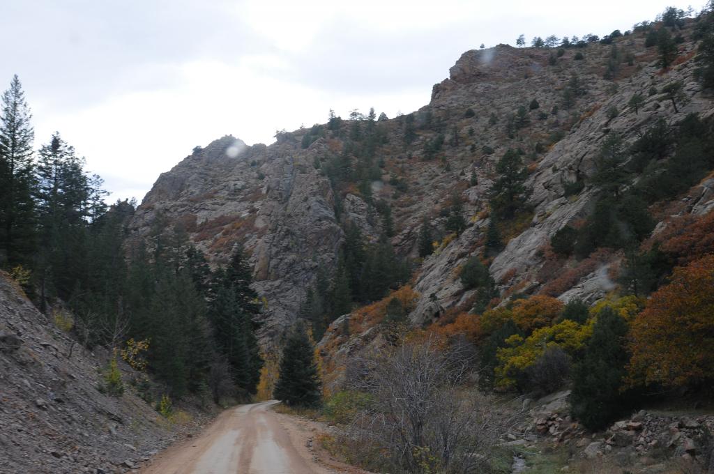
The colors weren't really bright that day because of a "late start" that I didn't realize would affect conditions for photography in the canyon where Shelf Road runs. The sun was either behind some clouds, or as I went along, behind the western ridge of the canyon. The next photos give you an idea of why it is called "Shelf Road."
Back on October 15, I finally got the opportunity to take a drive that I had been wanting to do ever since the Autumn colors started. It seemed that either the weather/clouds wouldn't cooperate or some family event was going on to prevent it from happening.
There are two different "roads" that are in a similar area of Colorado near to Canon City. About four miles east of Canon City is a junction that takes one up through Phantom Canyon Road. That road follows an old rail route that was abandoned after the mining in the area changed. It is a road designated on the maps as 67, although I don't know if it is classified as a forest service road or a county road. It runs from that junction east of Canon City up to the town of Victor, Colorado, which is a mining town.
The second road is Shelf Road and runs from the south side of Cripple Creek (only a few miles from Victor) back down to Canon City itself. I believe it is designated as 88, but again, I'm not sure if it is a county or a Forest Service road. Both roads have parts that are single lane roads, which necessitates one to pull over into a "wide spot" in the road to allow others to pass.
Since I've not gone through and worked the Phantom Canyon Road, this post is only about Shelf Road. It is one that requires a "high clearance" vehicle, although if it isn't washed by rains very much, I would drive a Ford F150 across it. But, being uncertain as to the road's condition, I made the trip that day in my nephew's Jeep Rubicon. Without further ado, allow me to share some photos of Shelf Road.
The start of my trip was from Cripple Creek, Colorado. This image gives no indication of what the road and the terrain will be like later on.


As I was driving along in one section, I spotted this "lady" cross the road in front of me. I stopped and took a picture of her without getting out. (You have to look fairly closely just above and just to the right of the center of the picture. She blends in quite well.)

It was a good thing that I didn't get out of the Jeep to take my photo, because when I looked over to my left after taking the above picture, I was met by the rest of the family.


The colors weren't really bright that day because of a "late start" that I didn't realize would affect conditions for photography in the canyon where Shelf Road runs. The sun was either behind some clouds, or as I went along, behind the western ridge of the canyon. The next photos give you an idea of why it is called "Shelf Road."


")