


Since our retirement benefits from the state will be a while coming, we've not been running around much. However, I've been on the computer (when the wifi is good) researching places to go see. I knew that there was a place called Beaver Creek State Wildlife Area (and what is part of the Beaver Creek Wildlife Study Area) that is right south of Mountaindale Cabins and RV Resort. So, I got to looking at things about it and it appears that there is only one way into it, and it has to be hiked after one gets to the trailhead.
Here is a bit of information that I found out about the Beaver Creek Wildlife area:
"Beaver Creek WSA is a hop, skip and a jump from many large towns in southern Colorado, sitting just north of Penrose. Easy access off of I25, Hwy 50 and 115, this wilderness study area spans a total of 40,000 acres of uninhabited backcountry. Well, uninhabited except for the largest concentration of Mountain Lions in the state, among other wildlife! In the center of it all is a 7.3 mile hiking loop. This beautiful area is full of dry creek beds, tall canyon walls, pristine flora/fauna and tons of my favorite rock, mica!"
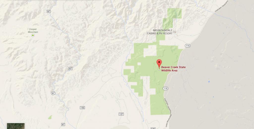
Pay close attention to the part above that is in bold and underlined. Now, here is an image taken from Google Maps that shows the proximity of the Beaver Creek area and Mountaindale Cabins and RV Resort.
So, all the above considered, I suggest that I not step outside and go, "Here, kitty, kitty, kitty."
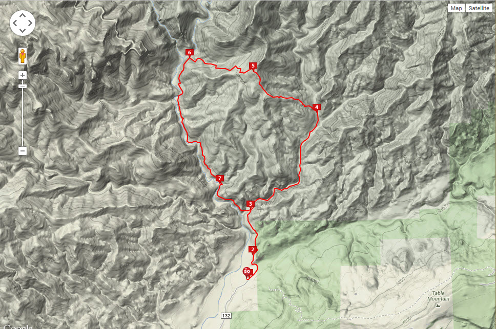
For those that hike, here is a topographical type map showing the hiking loop. It shows it to be something like 7.3 miles around, but another source shows it as 6.9 miles. That same source showing the 6.9 miles also says that it is only 2228 acres set aside for hiking and fishing.
I suspect that the 2228 acres is what is referenced in that last map, and the 40,000 acres is for the entire area, covering parts of El Paso, Fremont, and Teller counties. Here is a link about the smaller area:
Beaver Creek Loop
I thought I would share this for those that like hiking back country.
Here is a bit of information that I found out about the Beaver Creek Wildlife area:
"Beaver Creek WSA is a hop, skip and a jump from many large towns in southern Colorado, sitting just north of Penrose. Easy access off of I25, Hwy 50 and 115, this wilderness study area spans a total of 40,000 acres of uninhabited backcountry. Well, uninhabited except for the largest concentration of Mountain Lions in the state, among other wildlife! In the center of it all is a 7.3 mile hiking loop. This beautiful area is full of dry creek beds, tall canyon walls, pristine flora/fauna and tons of my favorite rock, mica!"
Pay close attention to the part above that is in bold and underlined. Now, here is an image taken from Google Maps that shows the proximity of the Beaver Creek area and Mountaindale Cabins and RV Resort.

So, all the above considered, I suggest that I not step outside and go, "Here, kitty, kitty, kitty."
For those that hike, here is a topographical type map showing the hiking loop. It shows it to be something like 7.3 miles around, but another source shows it as 6.9 miles. That same source showing the 6.9 miles also says that it is only 2228 acres set aside for hiking and fishing.

I suspect that the 2228 acres is what is referenced in that last map, and the 40,000 acres is for the entire area, covering parts of El Paso, Fremont, and Teller counties. Here is a link about the smaller area:
Beaver Creek Loop
I thought I would share this for those that like hiking back country.


 How long will it take you to get your first check?!?! Don't they just come like your payroll checks did?!!?!?
  (Just planning ahead ...
